

The deep Pacific Ocean is sending a clear signal: a climatic behemoth is stirring beneath the waves. Just as the world emerges from a weak La Niña, meteorologists and global forecast models are warning of a potential “Godzilla El Niño” brewing for late 2026, an event so powerful it could rival the historic 1997-98 and 2015-16 super El Niños that reshaped weather patterns worldwide. According to a report by The Week, scientists are closely monitoring oceanic and atmospheric signals that suggest this could become one of the most intense events in recorded history. With the National Oceanic and Atmospheric Administration (NOAA) recently adopting a new, more accurate measurement index, scientists now have a sharper lens to assess just how massive this event could become. For India, already grappling with geopolitical tensions and inflationary pressures, the stakes couldn’t be higher.
What Is a ‘Godzilla’ El Niño and Why Is 2026 Different?
The term “Godzilla El Niño” was first coined by NASA scientist Bill Patzert to describe the extraordinary scale of the 1997-1998 event that triggered catastrophic floods in California and droughts across Southeast Asia. As reported by The Economic Times, this transition from La Niña to El Niño typically brings significant weather disruptions, but a super El Niño represents the extreme end of the spectrum.
A super El Niño occurs when sea surface temperatures in the central-eastern equatorial Pacific (the Niño 3.4 region) rise at least 2.0°C above the long-term average for three consecutive months. The 2023-24 El Niño, while significant, barely touched this threshold. Current forecasts suggest the 2026 event could blow past it.
According to independent meteorologist David Schlotthauer, whose forecasts have been widely shared across weather platforms including The Inertia, “The latest oceanic and atmospheric signals continue to show a rapidly strengthening El Niño pattern developing for Fall 2026, and some forecast guidance suggests this event could become exceptionally strong if current warming trends continue.”
NOAA’s Game-Changing New Index: RONI vs ONI
Here’s where the science gets particularly interesting, and why this El Niño forecast demands attention. In February 2026, NOAA’s Climate Prediction Center adopted a new measurement system called the Relative Oceanic Niño Index (RONI) , replacing the traditional Oceanic Niño Index (ONI) that had been used for decades. NOAA’s official announcement explains that this change was necessary to account for background global warming trends.
Why the change? As explained by NOAA officials Michelle L’Heureux and Andrew Hoell, the old ONI struggled to keep pace with rapidly warming global oceans. RONI accounts for long-term ocean temperature trends by comparing the ENSO region to the global tropics, effectively stripping away the background noise of climate change to reveal the true El Niño signal. NOAA’s ENSO blog details how this methodological shift provides clearer insight into developing events.
This matters because, using the traditional ONI, recent El Niños appeared stronger than they actually were. RONI shows that the 2023-24 El Niño was actually 0.6°C cooler than previously thought. Conversely, when a genuine super El Niño emerges, RONI will confirm its intensity with unprecedented accuracy. Joel Lisonbee from NOAA’s National Integrated Drought Information System notes in the official release that this new index provides “a better representation of the seasonal climate variability” and will be crucial for drought early warning systems across the southern United States and beyond.
What the Models Are Saying: 80% Probability of Strong Event
The forecast models are converging on an alarming picture. Data collected from 11 different modeling groups, including Australia’s Bureau of Meteorology, the European Centre for Medium-Range Weather Forecasts (ECMWF), NASA, and NOAA itself, paint a consistent story.
According to a comprehensive analysis by The Inertia, the ECMWF models show staggering probabilities: 98% odds of at least a moderate El Niño by August 2026, 80% probability of a strong event, and crucially, a 22% chance of a super El Niño (exceeding 2.0°C anomalies). Climate scientist Daniel Swain, quoted in multiple reports, states bluntly: “All signs are increasingly pointing to a significant, if not strong to very strong, El Niño event.”
Even the more conservative NOAA estimates, released March 12, 2026, indicate a 62% probability that El Niño will emerge between June and August, persisting through at least the end of the year. The Economic Times coverage of these developments notes that Pacific Ocean temperatures beneath the surface have become increasingly warmer than normal, the classic precursor to El Niño development.
India Under Threat: Monsoon, Inflation, and the IOD Factor
For Indian readers, the “Godzilla El Niño” isn’t just a weather curiosity, it’s an economic and food security red alert. The State Bank of India released a sobering report on March 13, 2026, warning that weather patterns along with ongoing geopolitical risks could “adversely impact inflation in 2026.” According to The Economic Times, the SBI report highlights a dangerous confluence: the Indian monsoon is influenced by both ENSO and the Indian Ocean Dipole (IOD).
Currently, the IOD is in a negative phase. When a negative IOD coincides with El Niño, the combination typically produces a deficient monsoon. With El Niño formation probability ranging between 40-60%, according to SBI’s analysis, the implications for Indian agriculture are severe. The report specifically warns that “geopolitical risks continue to weigh on the outlook, with ongoing conflicts disrupting maritime trade and oil storage.”
Former Secretary of Earth Sciences Madhavan Rajeevan, in comments to The Economic Times, advises: “We should not panic, but we must watch closely.” The warning comes as India already faces geopolitical disruptions affecting global commodity markets, with ongoing conflicts creating what the SBI report calls “oil on water” situations that intensify commodity speculation.
The Week’s analysis further elaborates that a super El Niño could trigger heatwaves across northern and central India even before monsoon deficits become apparent, creating compound challenges for farmers and policymakers alike.
Global Fallout: From California Waves to African Floods
The cascading effects of a Godzilla El Niño would ripple across continents. UC Santa Cruz Research Director Patrick Barnard, an expert in coastal climate resilience quoted in The Inertia, explains what happened during previous super El Niños: “We’ve looked at a lot of winter storm conditions over the last 44 years, and typically, what happens is you get higher water levels along the coast of California, half a foot to a foot higher for the whole winter.”
Coastal Erosion and Wave Energy
The consistent factor across all major El Niños is dramatically increased wave energy. Barnard notes that wave heights can surge 50 percent above average during winter months, triggering extreme coastal erosion. The “steric effect”, where warmer water expands and takes up more room, raises baseline sea levels, meaning every high tide and storm surge amplifies coastal hazards.
Hurricane Seasons Reversed
El Niño creates a see-saw effect on hurricane activity. “El Niños actually reduce the number of Atlantic hurricanes because they increase wind shear,” Barnard explains to The Inertia. Storms forming in the Caribbean get knocked down before intensifying. However, the Pacific hurricane season typically gets “jacked up,” with increased storm activity threatening Mexico, Hawaii, and parts of Asia.
Drought and Deluge Patterns
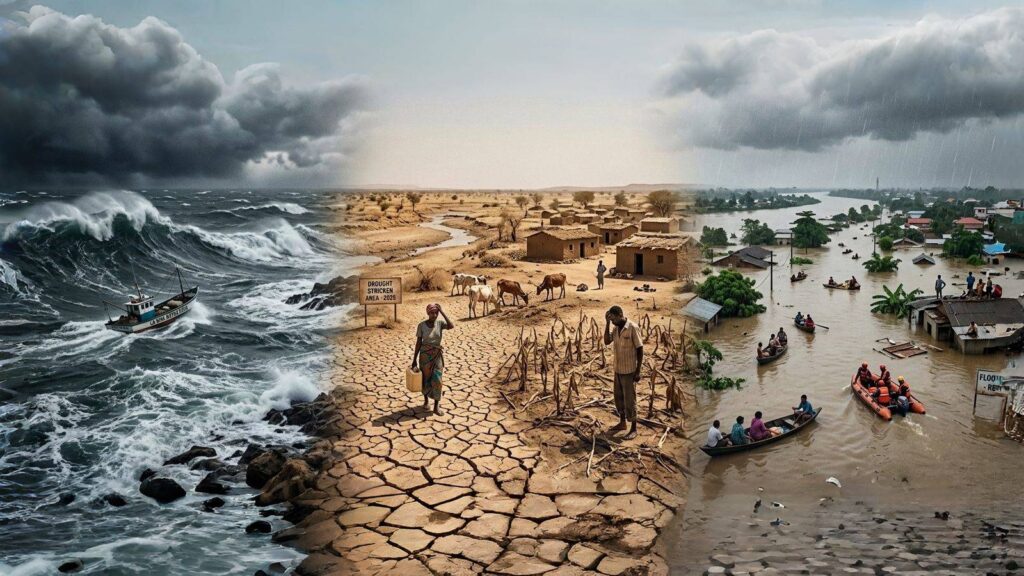
The map of chaos is predictable yet devastating. According to reports from The Week and climate researchers globally, the Horn of Africa, Peru, and the southern United States should prepare for potentially catastrophic flooding. Meanwhile, Southeast Asia and Australia face the opposite extreme: drought and heightened wildfire risk.
Will 2026 Shatter Global Temperature Records?
Perhaps the most alarming projection concerns global temperatures. El Niño acts as a release valve for oceanic heat, transferring energy from the Pacific into the atmosphere. Andrew Dessler and Zeke Hausfather, writing in The Climate Brink, analyze that global mean temperature can temporarily increase as much as 0.2°C during a very strong El Niño, with the maximum effect occurring three to four months after the event peaks.
Given that 2024 currently holds the record as the warmest year in human history, a super El Niño peaking in late 2026 would likely make 2027 the new record-holder, potentially by a sizable margin. The lag between El Niño’s peak and global temperature response means 2026 itself may not break records, but 2027 could shatter them.
This comes with an important caveat: the 2023-24 El Niño defied historical patterns by producing extreme heat earlier than expected, possibly due to the preceding “triple-dip” La Niña priming the system. Scientists admit uncertainty about whether 2026 will behave similarly.
Frequently Asked Questions About Godzilla El Niño 2026
Godzilla El Niño 2026 refers to a potential super El Niño event currently being monitored by NOAA and global meteorological agencies. The term “Godzilla El Niño” was first coined by NASA scientist Bill Patzert to describe the extraordinary scale of the 1997-1998 event that triggered catastrophic floods and droughts worldwide. A monster weather event of this magnitude occurs when sea surface temperatures in the Pacific rise at least 2.0°C above average for three consecutive months, with current models suggesting 80% probability of a strong event by August 2026.
India is on high alert for monsoon disruption because Godzilla El Niño 2026 typically weakens monsoon winds, leading to below-average rainfall across the subcontinent. The State Bank of India recently warned that this monster weather event, combined with a negative Indian Ocean Dipole (IOD), could trigger deficient monsoon conditions. Former Secretary of Earth Sciences Madhavan Rajeevan advises close monitoring as El Niño formation probability currently ranges between 40-60%, with potential impacts including heatwaves, drought, agricultural stress, and inflationary pressures.
Yes, Godzilla El Niño 2026 is expected to shatter global temperature records. Climate scientists Andrew Dessler and Zeke Hausfather from The Climate Brink explain that a very strong El Niño can temporarily increase global mean temperature by as much as 0.2°C, with maximum effect occurring three to four months after the event peaks. Since 2024 currently holds the record as the warmest year in human history, a monster weather event peaking in late 2026 would likely make 2027 the new record-holder, potentially by a sizable margin.
Preparing for the Inevitable
The scientific consensus is clear: we cannot claim surprise. “The importance of communication and coordinated action has increased in the current global environment,” the SBI report emphasizes, as covered by The Economic Times. For governments, the checklist includes clearing river courses, securing grain reserves, reinforcing electrical grids for surging air conditioner demand, and establishing alternative energy arrangements.
As one Mexican news analysis eloquently quoted in The Inertia puts it: “Despite all our technology of AI and satellites, we remain vulnerable to the cycles of water and air. 2026 is shaping up to be a year of extreme challenges where our capacity for adaptation will be put to the test.”
The ocean has issued its warning. Whether the world listens, and acts, before the heat becomes unbearable remains the defining question. For India, with its billion-plus population and agriculture-dependent economy, the coming months of monitoring and preparation will determine how well the nation weathers whatever the Pacific sends our way.

Vineet Gupta is the Founder and Managing Editor of MBA Study Point. He is an alumnus of the University of Wales, UK, where he completed his MBA. Along with his work across hospitality, finance, media, and academia, he has spent more than 14 years teaching MBA students at reputed institutions across India. His wide professional exposure and time spent observing people, workplaces, and cultures have shaped his interest in mindful living, leadership, and personal development. Through MBA Study Point, he brings together these experiences to help readers find clarity, balance, and practical wisdom for both career and life.